Aerial LiDAR Survey

RM Surveys captures high-precision aerial LiDAR data for complex and challenging sites.Supporting infrastructure, environmental, and construction projects, we deliver high-density point clouds, terrain models, and corridor mapping to keep works accurate, efficient, and on track.
Surveying drone landing after aerial mapping

Aerial LiDAR Surveys: Accuracy from Above

Aerial LiDAR surveys capture survey grade spatial data using advanced laser scanning technology mounted on unmanned aerial vehicles. This method is ideal for mapping large, complex, or vegetated areas, delivering precise 3D models and terrain data that support accurate planning, design, and analysis.

With extensive experience in aerial LiDAR capture, RM Surveys is a trusted partner for infrastructure projects, environmental monitoring, and asset management across Western Australia.

Our team combines cutting-edge LiDAR technology with repeatable survey control to deliver high-accuracy results, even in challenging environments.

Trust RM Surveys to provide the clarity, precision, and actionable data your projects demand.

Surveying drone landing after aerial mapping

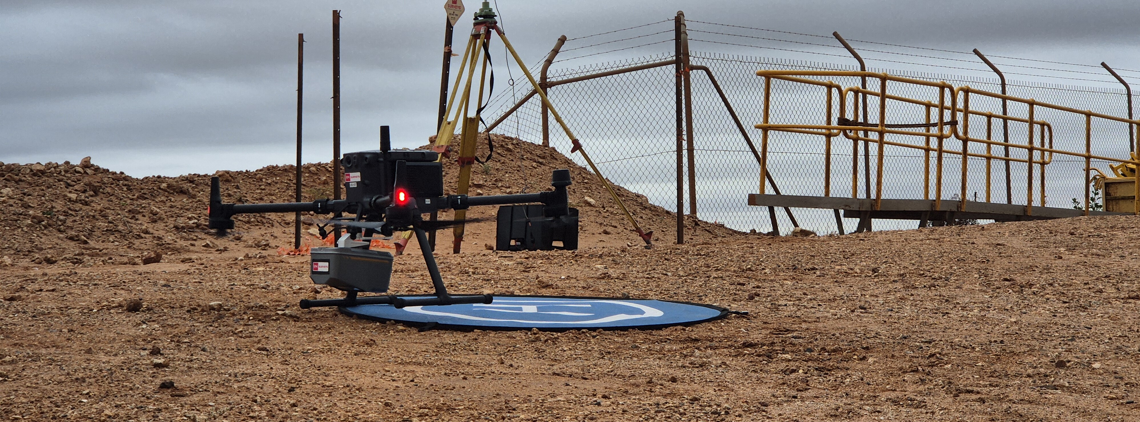
Accurate Aerial Data for Complex Site Assessments

Accurate aerial LiDAR surveying is invaluable across infrastructure, environmental, and resource sectors. It delivers the detailed terrain models, point clouds, and asset insights needed to plan with confidence, track progress, and mitigate risks.

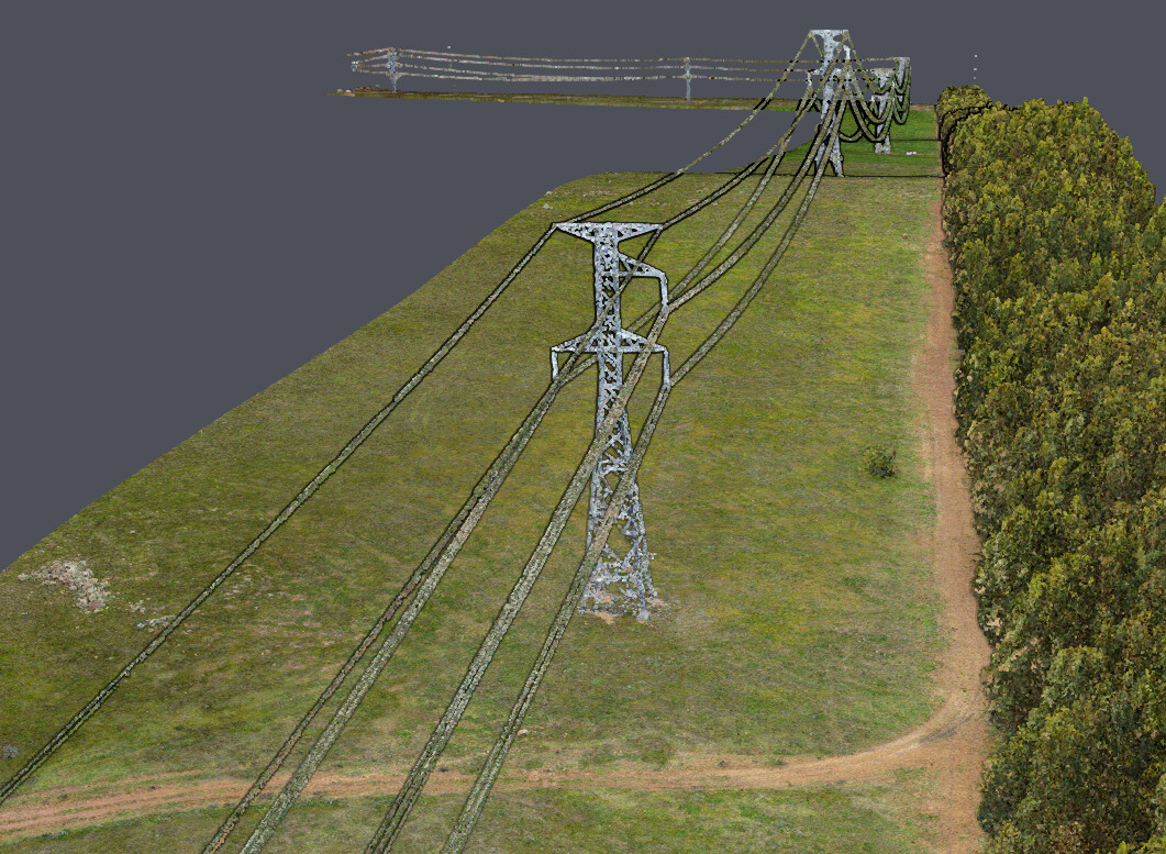
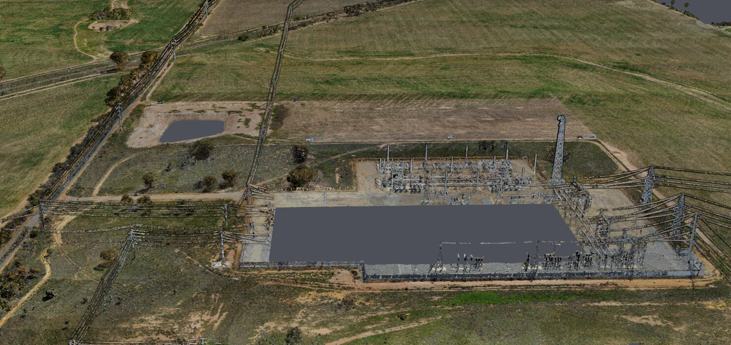
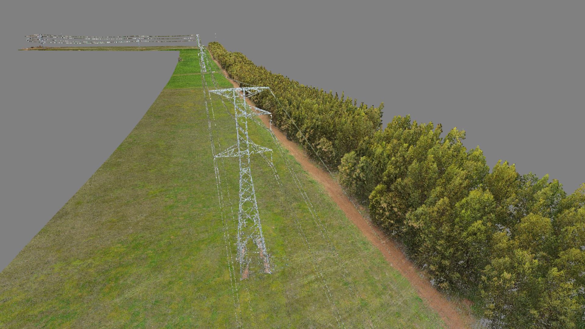
From wide-area mapping to corridor surveys and vegetation analysis, precision is key to reducing rework, improving safety, and keeping projects on track.

Empowering Decisions with Insight

Discover the full spectrum of RM Surveys’ Aerial expertise with our Capability Book.

Capability Statement

This downloadable document showcases our innovative approach, advanced technology, and proven track record in delivering aerial surveying solutions. Learn how we partner with businesses to unlock the digital potential of their assets.

Aerial LiDAR

Projects

View all projects
project image
1

Supporting WA’s Port Expansion with Precision and Innovation at Lumsden Point

RM Surveys is proud to be contributing to one of Western Australia’s most significant infrastructure developments- the Lumsden Point expansion project, led by Pilbara Ports Authority (PPA).

View more
project image
2

As-Built Electrical Infrastructure Survey at Collie BESS

RM Surveys successfully completed a multi-phase aerial LiDAR survey at the Collie Battery Energy Storage System (BESS), supporting detailed as-built documentation of electrical infrastructure to Western Power’s exacting drawing standards.

View more
project image
3

High-Resolution LiDAR Survey for Merredin BESS

RM Surveys recently delivered a high-resolution aerial LiDAR survey across approximately 112 hectares at the Merredin Battery Energy Storage System (BESS) site, supporting a detailed flood management study.

View more

What is an Aerial LiDAR Survey?

Aerial LiDAR (Light Detection and Ranging) uses laser pulses mounted on a drone to measure distances and create highly accurate 3D models of terrain and assets. It’s particularly effective in vegetated, remote, or hard-to-access areas.

What types of projects benefit most from Aerial LiDAR?

Infrastructure corridors (roads, rail, pipelines), environmental monitoring, large earthworks, mining operations, and asset inspections in complex terrain all gain from the efficiency and detail of aerial LiDAR.

How accurate is the data?

LiDAR captures dense, survey-grade 3D data quickly and safely over large or complex sites. It penetrates vegetation, performs in varied lighting conditions, and generates terrain models suited to engineering, environmental, and construction applications.

When combined with precise ground control and RM Surveys’ proven workflows, aerial LiDAR consistently achieves centimetre-level accuracy: delivering results you can rely on for critical design, planning, and compliance decisions.

Can the data integrate with my existing systems?

Yes. RM Surveys processes and formats aerial LiDAR data to integrate seamlessly with CAD, GIS, BIM, and other project platforms, ensuring it’s ready to use immediately.

Subscribe to RM Surveys News