Understanding utility survey classes – Class A, Class B, Class C and Class D
RM Surveys is a certified utility locator, meaning we are qualified to locate underground services for clients across various projects. As utilities are located underground, the most accurate method to determine the true position is to unearth or “pot-hole” it and measure directly to it.
Cost, time, and the risk of damaging the utility often prevent using the “pot-hole” method for every utility in the project area.
It is generally accepted that several utility searches and surveys will be performed with varying degrees of accuracy (and cost) over the design period of a road.
It is also not uncommon for the same utility survey to be performed multiple times if the period from planning to design to construction is spread over several years.
The Main Roads Underground Utilities Survey Standard (67-08-121) outlines four utility survey accuracy classes – Class A, Class B, Class C and Class D. These classes address the different types of utility surveys available during the design process and are presented as a series of options, not a course of compulsory action.
Class A
Accuracy Tolerance: Horizontal ±50mm, Vertical ±50mm
Method of Detection and Location: Utilities potholed and traced / or surveyed at installation
Risk of Utility Damage During Project Works: Low
Class B
Accuracy Tolerance: Horizontal ±300mm, Vertical ±500mm
Method of Detection and Location: Utilities located and marked (Electro / GPR)
Risk of Utility Damage During Project Works: Medium
Class C
Accuracy Tolerance: Horizontal ±500mm, Vertical Unknown
Method of Detection and Location: Visual utility identification (Pits & Manholes Surveyed)
Risk of Utility Damage During Project Works: High
Class D
Accuracy Tolerance: Horizontal & Vertical Unknown
Method of Detection and Location: DBYD Plans or unknown source
Risk of Utility Damage During Project Works: High
Class A Utility Survey
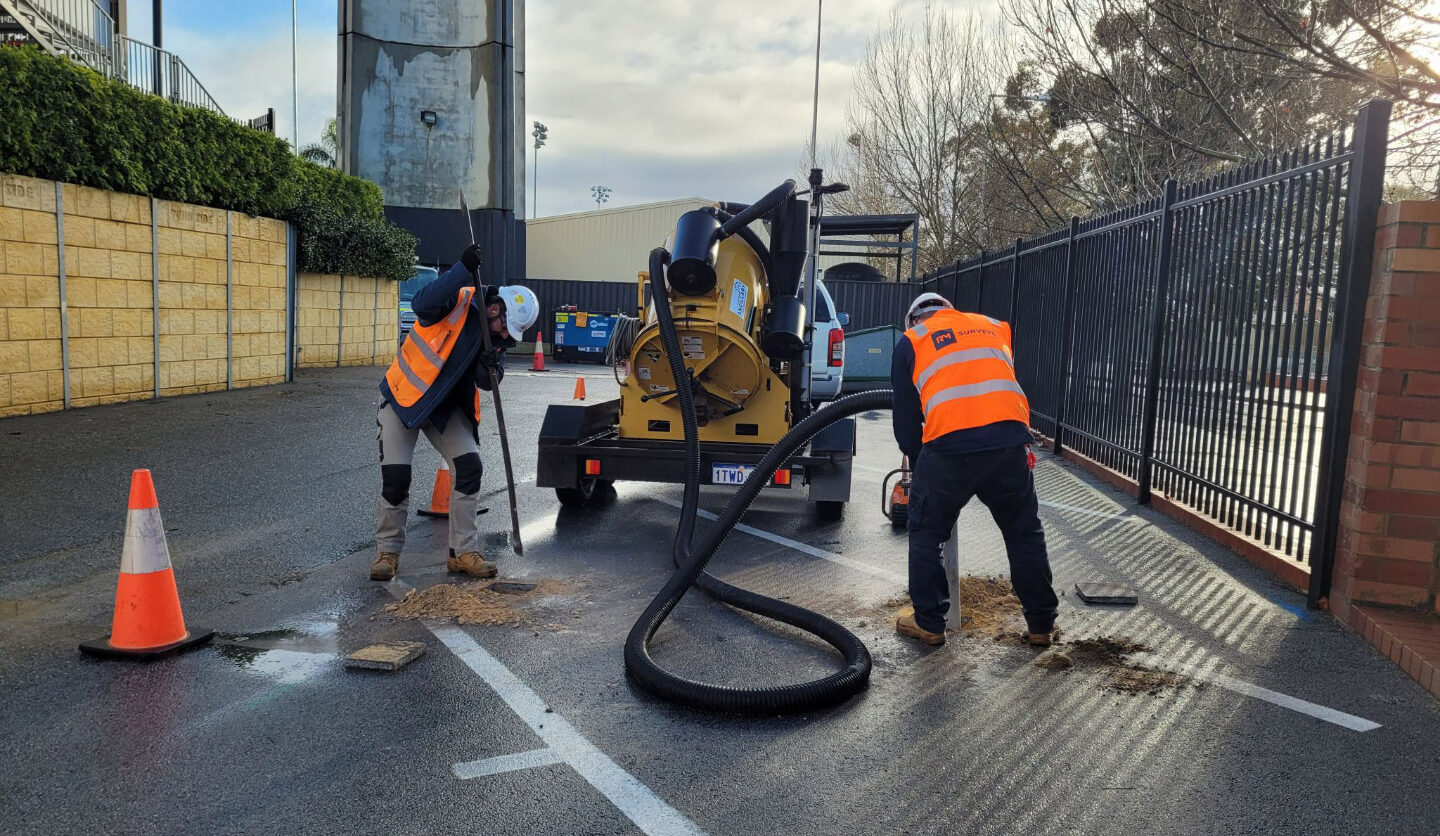
A Class A utility survey is requested on pre-determined utilities identified in a Class D or Class C utility survey that may conflict directly with the road design. A Class A utility survey requires the utility to be “potholed” (exposed) and directly measured by a total station, theodolite or RTK GPS instrument. The expected accuracy for locating the utility is + or – 0.03 m for x, y & z.
The cost for performing this survey is high as the utility is underground and requires machinery and authorised officials to unearth it. Additionally, the amount of data produced from this survey is restrictive due to the amount of utility that can be unearthed.
A Class A utility survey is costly and involves the risk of trying to expose and measure the utility without damaging or affecting the integrity of the utility in any way. The project manager and RMS must work together to determine where the utilities are located economically. Assumptions on pipe directions and joins to maintenance holes and structures must be minimised, and all practical efforts must be made to minimise disruption or damage.
Utility data gathered under Class A is considered “verified” as the utilities have been directly measured, and their position has been confirmed underground.
Class B Utility Survey
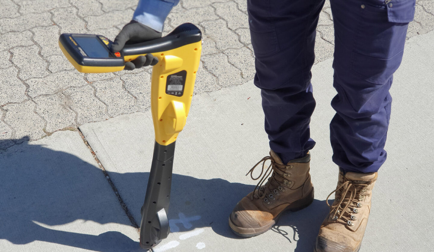
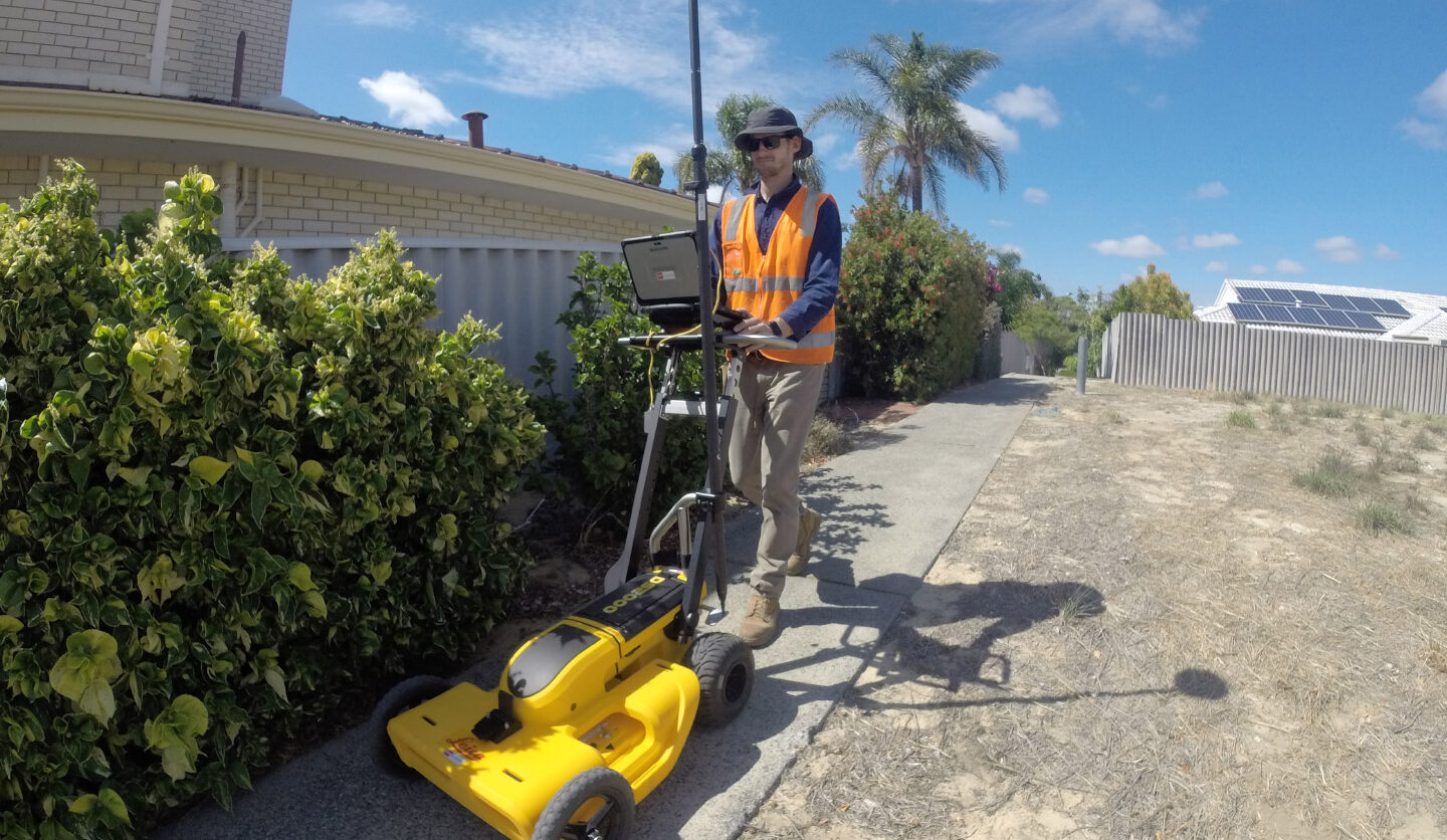
A Class B utility survey requires the underground utilities to be surveyed indirectly. Several different survey techniques can perform an indirect survey. These can include ground penetrating radar, resonating frequency survey, etc. An indirect survey is a method that does not require the utility to be unearthed.
It must be noted that from this type of survey, the ground conditions, the depth of the utility and the material the utility is constructed from can affect the final accuracy of the location of the utility.
Accuracies to be achieved are typically + or – 0.1m for distances less than 1.2m under the surface and + or – 0.3m for underground depths greater than 1.2m. These accuracies are nominal and may vary due to different techniques employed to locate the utilities.
Significantly, a Class B utility survey does not disturb the underground utility. The integrity of the utility will not be compromised and does not have the same potential issues related to safety or potential damage when a utility is unearthed.
Class C Utility Survey
A Class C utility survey is a Class D utility request (as above) but is additionally performed in conjunction with a standard (above ground) ground survey or (aerial) mapping request.
The below-ground utility data (pipes etc.) are then adjusted to match the surveyed above-ground services features (maintenance hole, breather pipes etc.). A Class C utility survey does not guarantee the location of the underground service even though the data is altered to match above-ground surveyed objects (i.e. pipes adjusted to fit survey maintenance holes, breather pipes etc.).
Underground utility data can be tough to interpret and sometimes difficult for the utility consultant to determine which underground feature matches an above-ground surveyed feature.
Previous utility work has shown that services may not travel the shortest possible distance between known maintenance hole lids and that pipe directions can change underground due to underground barriers.
Additionally, utilities do not always join the centre of maintenance holes or can run past above surface features. Therefore, the consultant providing the underground utility data cannot guarantee the location of the utilities. For these reasons, the collected Class C utility data is labelled as “unverified” as the utility’s information is only considered an “assumed” location of a utility given that it has not been physically measured.
A Class D or Class C utilities survey should provide enough information to the client to determine whether utilities are within, near or crossing the project area. Where any utility from the Class D or C utility survey is identified as potentially impacting a road design, or crossing a road alignment, then an additional utility survey of a higher order and cost (Class A or B) will be required.
To assist the project manager in accurately locating utilities and provide survey options for collecting utilities with higher accuracy, a description of Class A and Class B utility surveys has been provided.
Class D Utility Survey
A Class D utility survey is the most basic utility search request and is the first step toward collecting utility information on a project. It requires a consultant to identify all the utilities within a defined project area (scope of works)
RMS will contact DBYD and other unlisted utility providers on behalf of the client to collect all known existing drawings, plans and digital utility data. As utility information comes in many different formats, the information must be converted by RM Surveys into a format the client can utilise in its existing planning and design software.
It is important to note that the accuracy of Class D data is unverified, meaning the actual position underground may differ significantly from what is denoted on a plan or digital data provided by the utility provider.