Why Topographic Survey Data Still Underpins Every Successful Project
In every sector RM Surveys works across, including infrastructure, mining, property, and construction, projects are becoming more complex, more regulated, and less tolerant of error.
Yet despite advances in modelling, automation, and digital delivery, one dependency remains unchanged: high-quality topographic survey data.
Topographic data is still the first dataset most projects rely on. When it’s wrong, outdated, or poorly structured, the consequences cascade quickly.
Topographic survey data continues to underpin successful projects. Its quality directly influences cost, risk, approvals, and delivery, and sets the standard that asset owners and project teams should demand today.
Key takeaways: Why topographic survey data matters
- Topographic survey data is the foundation for design, approvals, and construction.
- Accuracy, resolution, and currency directly affect risk, rework, and cost.
- Outdated or inconsistent data is a common cause of delays.
- Modern capture methods only deliver value when paired with expert interpretation.
- Well-structured data supports digital workflows, real-time insights, and informed decision-making.
- Fit-for-purpose outputs are critical for engineers, planners, and contractors.
- RM Surveys delivers validated, traceable topographic survey data that integrates across the asset lifecycle.
Topographic survey data is still the first critical dependency
Topographic survey data is the starting point for every project workflow. From the outset, designs rely on the assumption that the model reflects real ground conditions, an assumption that introduces risk when the data is inaccurate or outdated.
Topographic survey data defines existing terrain, built features, surface drainage, access constraints, boundaries, and interfaces with surrounding assets. It informs:
- Early feasibility and cost planning
- Concept and detailed design
- Planning and environmental approvals
- Construction sequencing and temporary works
If this data is incomplete or inaccurate, every downstream decision inherits that uncertainty. In many projects, problems that surface during delivery often come down to early topographic survey data that was:
- Collected too early and never updated
- Captured at insufficient resolution
- Reused beyond its original purpose
Topographic survey data is not a box to tick. It is a strategic input that underpins confidence in design decisions, approvals, and construction outcomes.
Accuracy, resolution, and currency drive design confidence
For asset owners and project teams, the difference between usable topographic survey data and problematic data comes down to three practical measures:
Accuracy
Accuracy defines how reliably features are positioned on the ground. If accuracy is poor, distances, levels, and alignments cannot be trusted.
Resolution
Resolution determines how much detail is captured. Higher resolution reveals subtle terrain changes and site features that can affect design and construction.
Currency
Currency confirms whether the data reflects current site conditions. Even accurate data loses value if the site has changed since it was captured.
Together, these factors directly influence:
- Design tolerances and constructibility
- Clash detection and interface management
- Volumes, cut/fill calculations, and drainage modelling
- The credibility of submissions to approving authorities
For engineers and planners, poor topo data forces conservative assumptions. For contractors, it increases contingency and rework. For asset owners, it introduces avoidable cost and risk before construction even begins.
High-quality topographic survey data reduces unknowns, translating into faster decisions, fewer surprises, and more reliable cost and budget outcomes.
The real cost of relying on outdated or inconsistent data
Using outdated topographic survey data is one of the most common and costly mistakes in project planning.
Topographic survey data becomes outdated because sites change over time, services are installed or removed, surrounding assets evolve, and temporary works alter surface conditions.
When teams rely on legacy data, the impacts are tangible:
- Redesign late in the approvals process
- Construction delays due to unforeseen clashes
- Safety risks from incorrect surface or access information
- Budget overruns caused by inaccurate quantities
In long-life or staged assets, inconsistency between datasets can be just as damaging. When each phase uses different survey standards, coordinate systems, or validation methods, alignment issues compound over time.
As projects increasingly rely on integrated digital systems, inconsistencies in data structure, coordinate control, or validation can also disrupt downstream platforms, limiting the usefulness of otherwise accurate data.
From capture to usable data: where projects often fall short
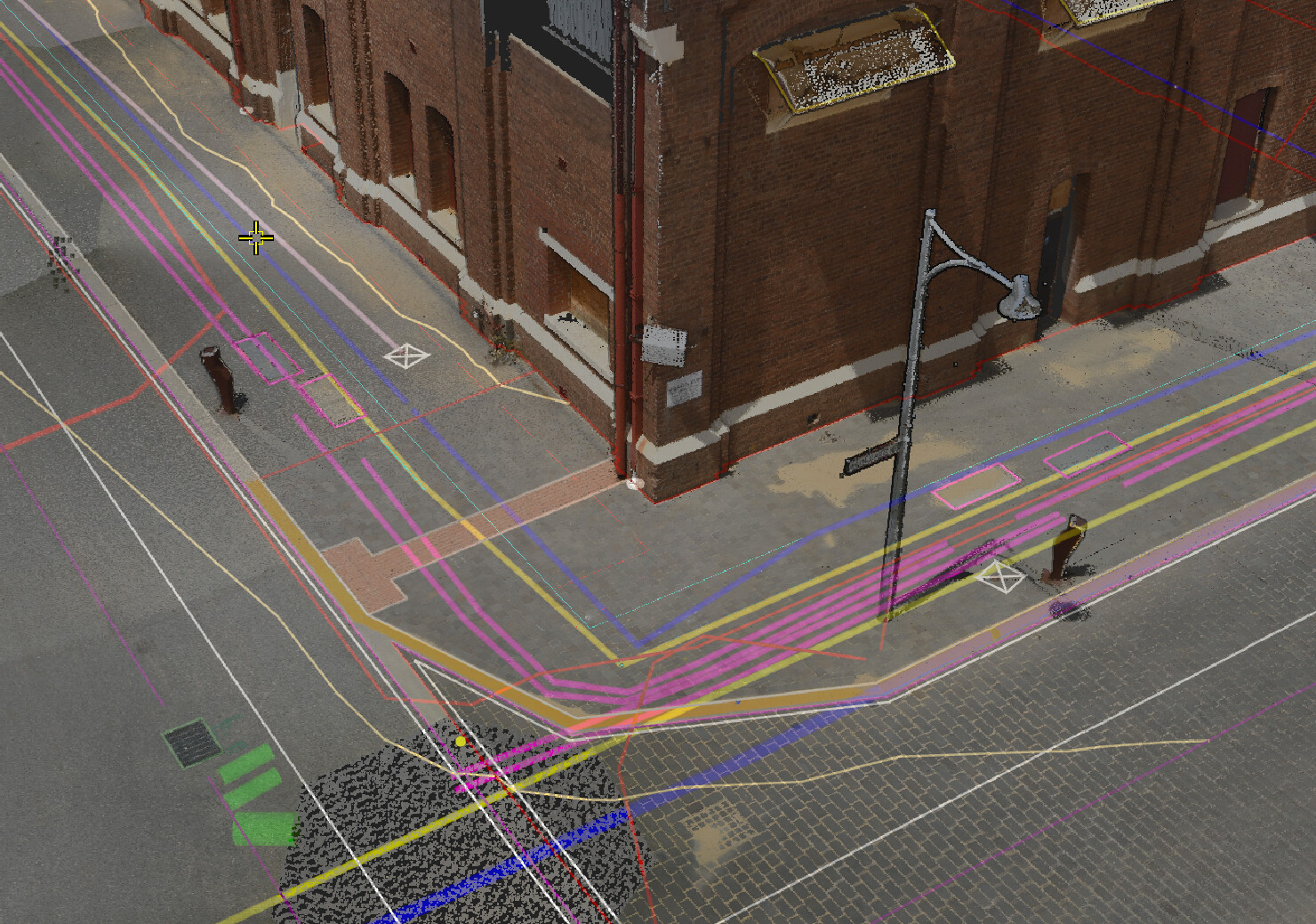
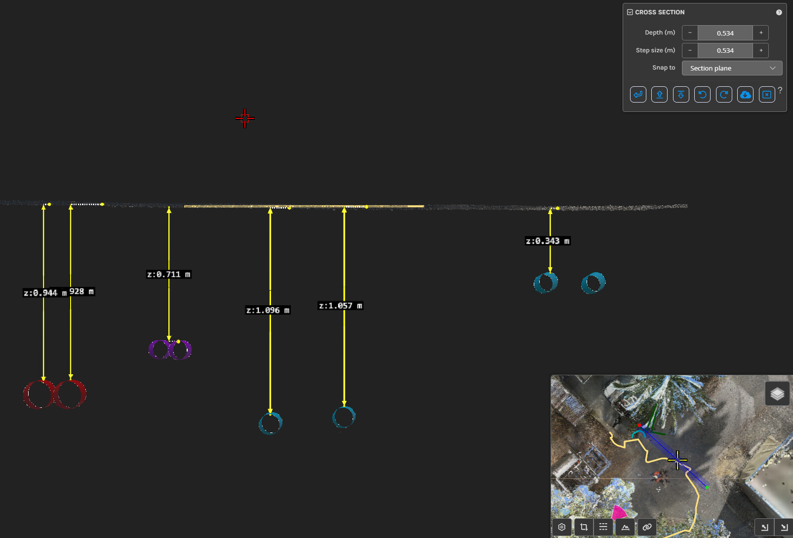
Aerial LiDAR surveys, mobile mapping, UAVs, and terrestrial laser scanning have transformed how topographic survey data is captured.
However, most project challenges no longer come from how data is captured, but from how it is processed, structured, and applied.
Raw datasets still require:
- Validation against control
- Intelligent filtering and classification
- Engineering judgement to interpret anomalies
Without this step, high-density data can introduce ambiguity rather than clarity, particularly when multiple stakeholders rely on it across design and construction.
At RM Surveys, capture is only one part of the process. Equal focus is placed on how data is verified, structured, and prepared for use downstream
Designing data for digital delivery environments
As projects adopt BIM, GIS, and integrated digital workflows, expectations around survey data have shifted.
It is no longer sufficient for data to be accurate in isolation. It must also be:
- Structured consistently
- Aligned to project coordinate systems and standards
- Compatible with design and modelling platforms
This is where many datasets fall short – not in accuracy, but in usability.
Well-prepared topographic survey data supports:
- Direct integration into design models
- Coordination across disciplines
- Clearer communication between project stakeholders
In contrast, poorly structured data often requires rework, reinterpretation, or duplication – introducing delays that are not always immediately visible.
Supporting ongoing visibility, not just point-in-time delivery
Topographic survey data has traditionally been treated as a point-in-time deliverable. Increasingly, projects require it to support ongoing decision-making.
This is particularly relevant where:
- Sites are evolving during staged construction
- Risks need to be monitored over time
- Multiple datasets are being combined
In these environments, consistency, traceability, and accessibility become as important as initial accuracy.
Drawing from broader industry practices, including automated monitoring and real-time data environments, project teams are placing greater emphasis on:
- Data that can be revisited and validated over time
- Clear links between survey epochs
- Structured outputs that support integration with dashboards or reporting platforms
This does not change the role of topographic survey data, but it does expand how it is expected to perform across the project lifecycle.
Consistency and control across the asset lifecycle
For multi-stage projects and long-life assets, survey data must remain reliable beyond initial delivery.
That means:
- Consistent control frameworks
- Documented accuracy and methodology
- Repeatable processes across survey updates
Where these are missing, project teams often lose confidence in earlier datasets, leading to unnecessary re-surveying or duplicated effort.
Maintaining consistency supports:
- Alignment between design, construction, and operations
- Reduced risk when updating or extending assets
- More efficient integration into asset management systems
How RM Surveys delivers topographic data that works downstream
RM Surveys approaches topographic survey data as part of a broader asset lifecycle, not a standalone deliverable.
Our people work closely with asset owners, engineers, and planners to understand:
- How the data will be used
- Where risk is most concentrated
- What level of accuracy and detail is required
This results in survey strategies aligned to project outcomes, validated and traceable datasets, and outputs designed for immediate use in design and construction.
Where required, we also support alignment with digital delivery requirements, ensuring data can be integrated into design models, coordination workflows, and project systems without rework.
Getting more value from the same data
Topographic survey data remains the foundation of successful projects because it defines real-world conditions.
What is changing is not its importance, but the expectations placed on it.
Projects now require data that is:
- Accurate and current
- Structured and consistent
- Ready to integrate into digital workflows
When these requirements are met, survey data does more than support design – it enables better coordination, clearer decisions, and more efficient delivery.
RM Surveys delivers topographic survey data that is prepared for how projects operate today, from early planning through to construction and ongoing asset management.
If you’re planning a project or reassessing the quality of your existing survey data, contact our team about a fit-for-purpose topographic survey approach.
Engineers and surveying professionals interested in working on projects where accuracy matters can view current opportunities on the RM Surveys careers page.

Frequently asked questions about topographic survey data
How accurate does topographic survey data need to be?
Accuracy should be defined by project risk and use. Early feasibility requires less precision than detailed design or construction. RM Surveys aligns accuracy to purpose, not assumptions.
How often should topographic surveys be updated?
Any time site conditions change materially or before major design or construction milestones. Reusing old data without validation introduces unnecessary risk.
Is LiDAR always better than traditional survey methods?
No. LiDAR is powerful, but not always appropriate. Ground conditions, required accuracy, and feature type determine the right method.
What’s the biggest mistake teams make with topo data?
Assuming it can be reused indefinitely or for purposes it was never captured for.
Can topo data support asset management after construction?
Yes, when structured correctly. High-quality topo data becomes a valuable reference for maintenance, upgrades, and future works.
Need help with a topographic survey or compliance question?
Our licensed surveyors are here to help.
Contact RM Surveys