Perth Zoo Gibbon Crossing: Spatial Data For Elevated Habitat Design

Geospatial & DigitalUnderground Utility Mapping

PROJECT OVERVIEW

High-precision survey and utility mapping for Australia’s first immersive gibbon habitat.

RM Surveys proudly supported the design and delivery of Perth Zoo’s Gibbon Crossing- Australia’s first immersive gibbon habitat, officially opened in June 2025. This exhibit is part of Perth Zoo’s $51 million Master Plan focused on species-first design.

We were engaged to deliver early-stage spatial data to inform design and construction. Our Geospatial and Utility Mapping (UM) teams captured accurate, high-resolution data in a high-traffic, sensitive environment. Tree height and canopy spread were especially critical to ensure habitat safety and functionality.

SPATIAL INPUTS THAT SHAPED THE HABITAT

WHAT WE DELIVERED

FEATURE SURVEY OF THE EXHIBIT SITE
POINT CLOUD & CANOPY MODELLING
UNDERGROUND UTILITY MAPPING
DATA INTEGRATION VIA POINTERRA

TURNING DATA INTO DESIGN

TECHNICAL HIGHLIGHTS

From habitat safety to construction feasibility, early-stage spatial data shaped every element of the Gibbon Crossing.

The design relied on vertical movement, tripling the gibbons’ range through elevated rope pathways. RM’s spatial data enabled safe architectural alignment, civil layout, and accurate clearance mapping in a dense, heritage-sensitive setting.

FEATURE SURVEY

RM Surveys conducted a detailed Feature Survey of the proposed exhibit site and surrounding environment. This formed the spatial foundation for habitat planning- capturing critical elements such as tree positions, canopy spreads, terrain features, and existing infrastructure. This data enabled architects and engineers to design with confidence, knowing their plans were aligned with real-world conditions.

POINT CLOUD & MODELLING

Using high-accuracy laser scanning, we generated a dense point cloud of the habitat zone. From this, our team extracted detailed features and produced terrain models to support vertical alignment, structural clearance checks, and habitat safety assessments. This was particularly important in ensuring gibbons couldn’t leap to unintended areas, maintaining both animal welfare and public safety.

UTILITY MAPPING & INTEGRATION

Our Utility Mapping (UM) team identified and located underground services across the site, including electrical, water, and communication lines. This data was integrated with the survey model to help guide civil works, reduce the risk of service strikes, and streamline construction planning in what was a complex, live environment.

Getting hands-on involvement with such a culturally significant landmark is something I’ll cherish for a long time. Survey is a small but hugely significant part of planning projects like this.

David Winters, Lead Surveyor – Geospatial
Background Image

TECHNICAL DELIVERABLES

Delivered in usable formats to support seamless coordination, design integration, and remote project review.

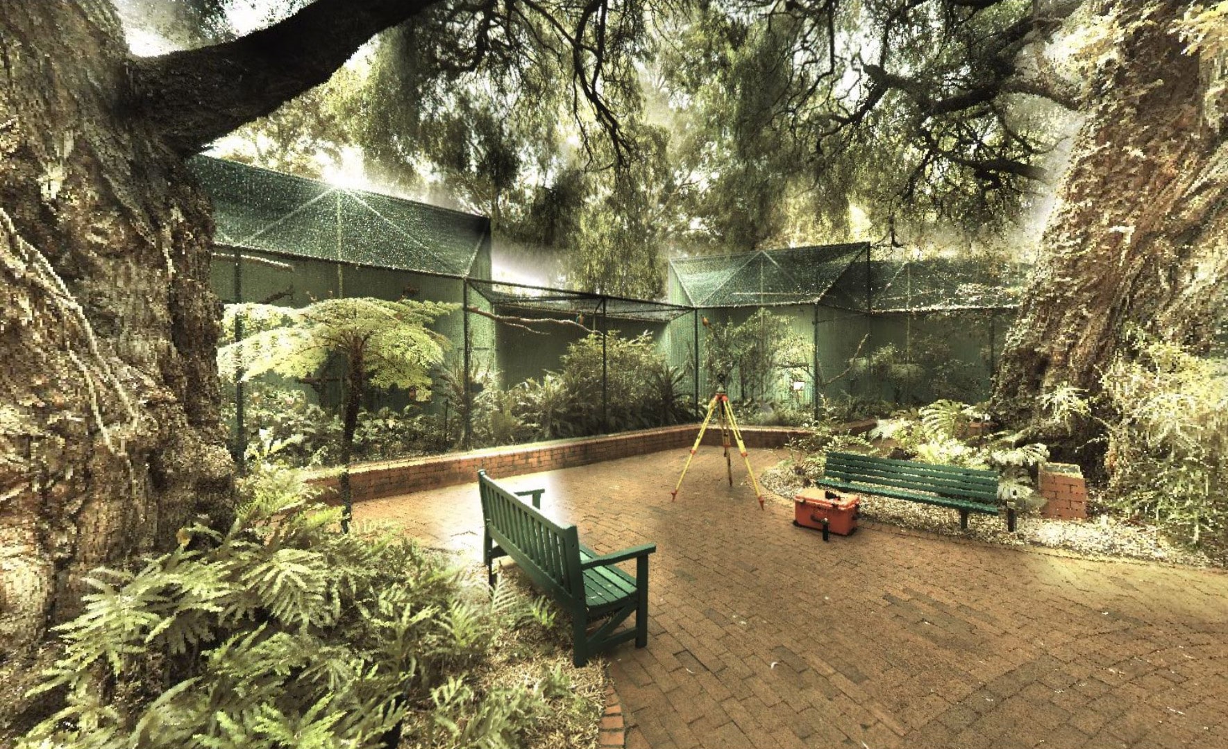
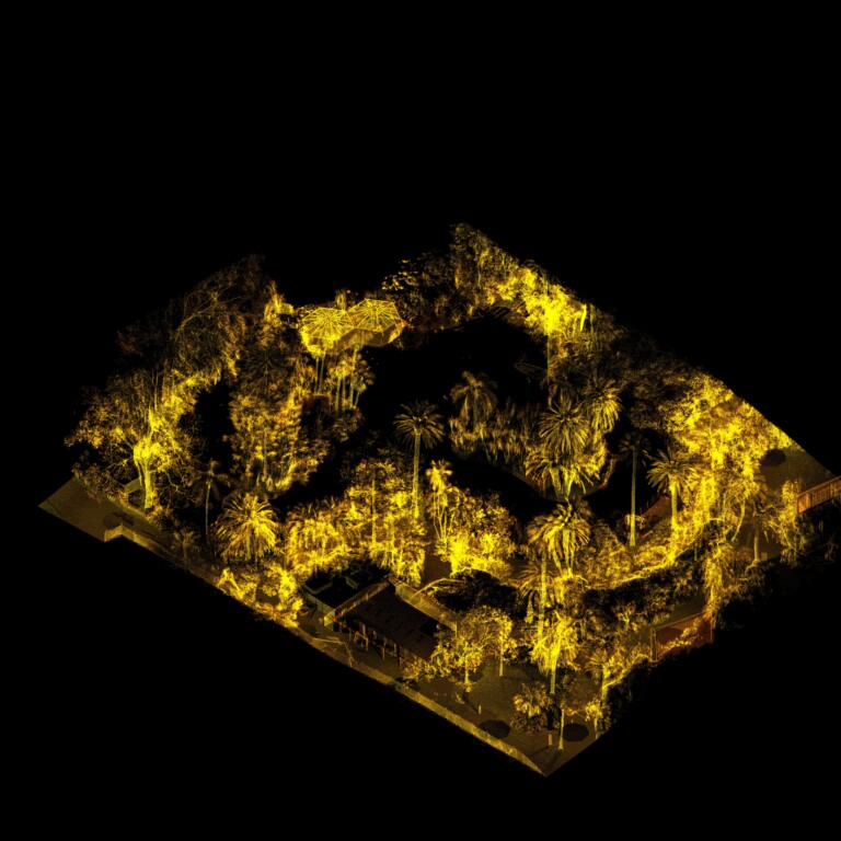
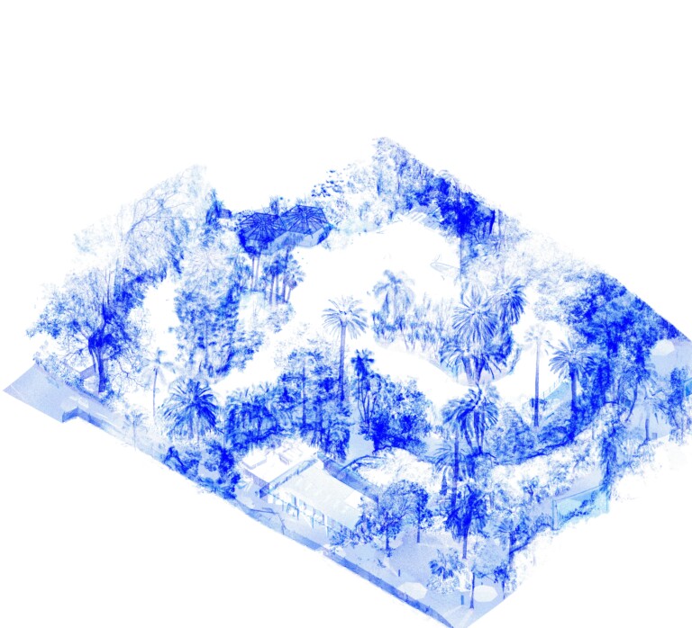
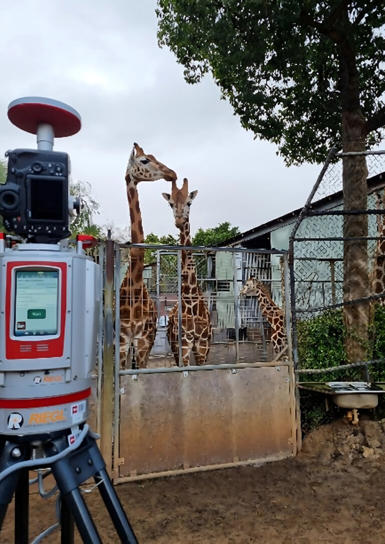
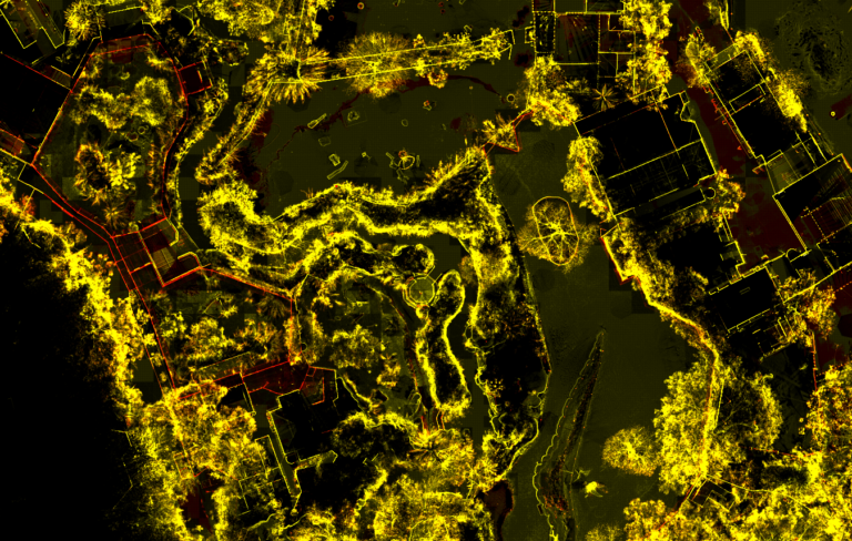
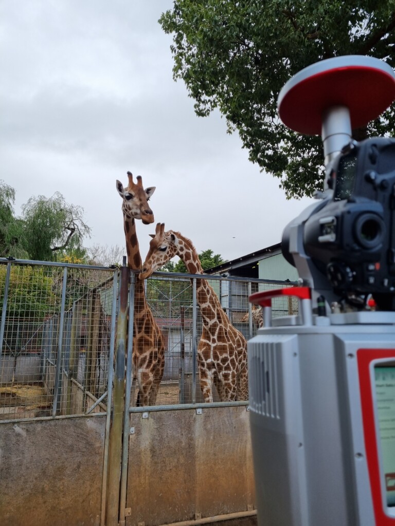
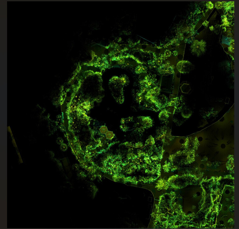
RM Surveys delivered a set of high-accuracy spatial datasets to support the planning and construction of the Gibbon Crossing.

These included a detailed feature survey, high- resolution point cloud, extracted canopy data, terrain models, and utility mapping outputs. The data was used to assess vertical clearances, confirm tree canopy proximity, align structural elements, and locate underground services.

All datasets were made accessible to project partners via Pointerra for remote review and coordination.

Other Projects

View all projects
project image
1

As-Built Electrical Infrastructure Survey at Collie BESS

RM Surveys successfully completed a multi-phase aerial LiDAR survey at the Collie Battery Energy Storage System (BESS), supporting detailed as-built documentation of electrical infrastructure to Western Power’s exacting drawing standards.

Aerial LiDAR was specifically requested and proved to be the only viable method for capturing the complex site layout with the required precision and consistency. Our team mobilised quickly and established robust, repeatable survey control across multiple visits, ensuring seamless data integration and accuracy throughout the project lifecycle.

View more
project image
2

Locating and Mapping the Underground Assets for Curtin University

At RM Surveys, our strategic mission is to unleash the full potential of our clients’ assets. A consultant commissioned us to locate and map underground assets to play a crucial role in informing design decisions for Curtin University.

We employed a meticulous blend of Class A and Class B locating techniques to achieve this. This approach ensured the utmost cost-effectiveness for our client and guaranteed a thorough underground investigation, particularly in areas most susceptible to development-related risks.

View more
project image
3

High-Resolution LiDAR Survey for Merredin BESS

RM Surveys recently delivered a high-resolution aerial LiDAR survey across approximately 112 hectares at the Merredin Battery Energy Storage System (BESS) site, supporting a detailed flood management study.

Our ability to rapidly mobilise and deploy aerial LiDAR technology enabled us to capture the expansive area with exceptional accuracy and efficiency, something that would have been impractical using traditional ground-based methods. Although the survey was initially commissioned by a single consultant, the high-quality dataset has since proven invaluable to a broader group of stakeholders, including engineers, planners, and environmental consultants.

View more